Nagaland University researchers have completed a GIS-based hydrological study examining land use change and river flow in the North Eastern Himalayan hills.
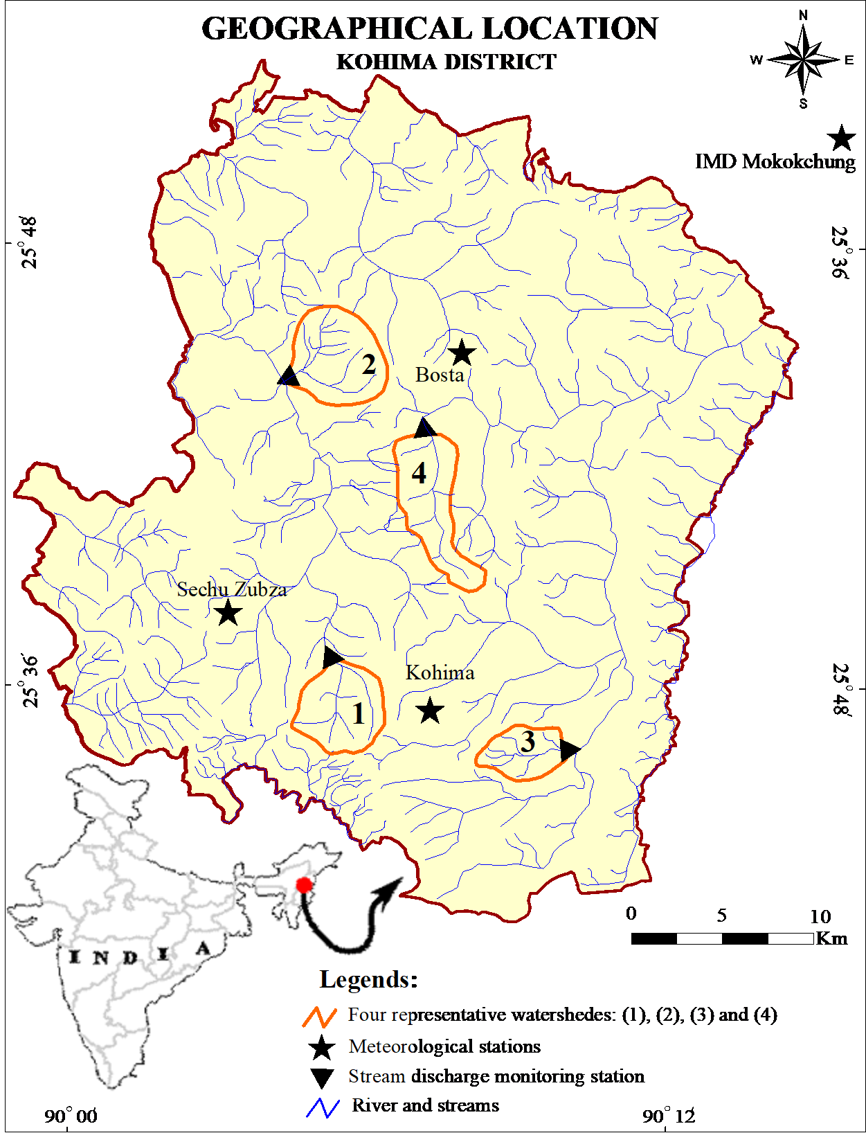
The research investigates how geo-ecological conditions and human activities influence runoff, river discharge and seasonal water availability in a region known for limited hydrological data. Conducted across four experimentally monitored watersheds in Kohima district, the study combined geospatial analysis with systematic field measurements to generate continuous stream discharge data under different land-use systems. These included dense forests, open forests, agricultural areas and urban landscapes.

The team developed a four-zone runoff classification—low, moderate, high and very high—to support watershed planning and flood mitigation. Findings show that dense forests absorb rainfall effectively and sustain sub-surface flows during non-monsoon months, while urban and modified landscapes produce higher monsoon runoff and reduced lean-season flows. Runoff ratios were used to quantify these differences, highlighting the hydrological impact of increasing anthropogenic stress.
Published in a peer-reviewed journal, the study was conducted by researchers from Nagaland University and Asian International University, with funding support from Nagaland University and the Ministry of Tribal Affairs. The findings are expected to assist policymakers, planners and local communities in strengthening flood management and sustainable water planning in fragile hill ecosystems.
For more news and update, click here to download our mobile app – Veritas Daily
To explore advertising or sponsorship collaborations, click here to contact us

Leave a Reply